The Follies Project
Places with Meaning, Onchain
A framework for worlds.
A framework for worlds.
The Follies Project creates small, story-rich places called Follies - generative, onchain structures that games, worlds, and communities can build with.
● Explore this Quick Guide
● Read the Litepaper (PDF)
● Open the White Paper (Gitbook - Coming Soon)
● Venture into The Follies Archive (Lore + Meta - Coming Soon)
A Folly is a small place with a purpose - a shrine, gate, altar, or structure that affects characters, stories, or the world around it. Follies are the building blocks for story-rich worlds.
The Follies Project is a real-time blockchain installation exploring architectural place through web3 technology and art primitives. The Follies Project is also a framework. Loot Follies is one activation of that framework. Anyone can build their own.
The Follies Project is a real-time blockchain installation exploring architectural place through web3 technology and art primitives. The Follies Project is also a framework. Loot Follies is one activation of that framework. Anyone can build their own.
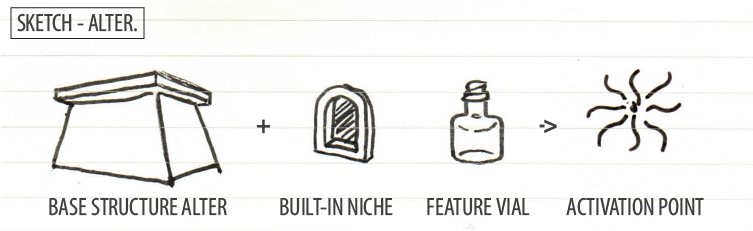
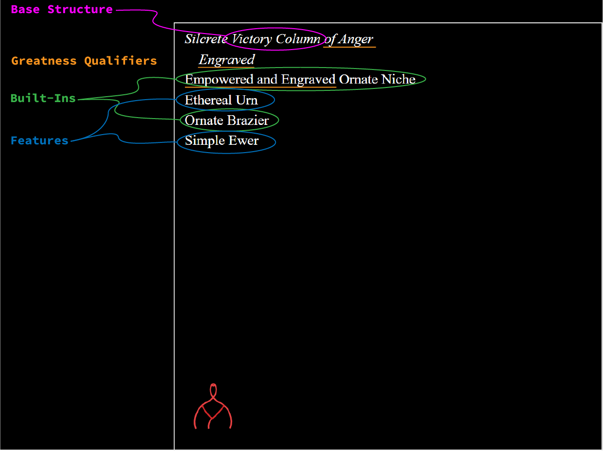
A Folly is defined by its structure, its elements, and its meaning.
The Morphology of a Folly
Every Folly is built from six simple parts.
- Base Structure The core architectural form, defines the primary use.
- Built-Ins Carved or integral elements.
- Features Objects on, around or in the structure.
- Greatness A 1-20 value that adds layers of meaning.
- Episodic Memory A trio of numbers hinting at past events:
- Coordinates Right Ascension + Declination for world and sky mapping.
Different views reveal different parts of a Folly's morphology.

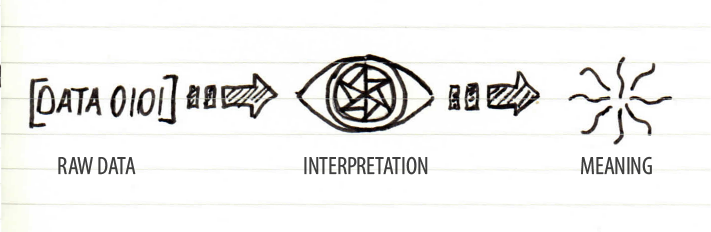
The Three NFT Lenses
Every Folly can be viewed through three lenses, each revealing different information.
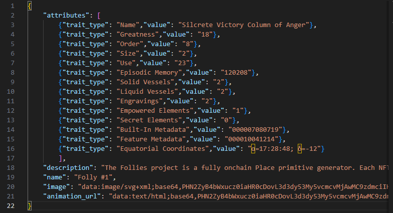
JSON
The raw data - for games, apps, and builders.
The Logoi
A simple text description - easy for humans to read.
The CypherGlyph
A radial glyph - reveals hidden relationships in the data.
Why the Numbers Matter
Numbers lend meaning through interpretations.
Every Folly's attributes are defined by simple integers.
Because the system is numeric, any world can interpret the same Folly differently.
- A shrine might heal you in one game
- Curse you in another
- Reveal lore in a story
- Act as a waypoint in a world
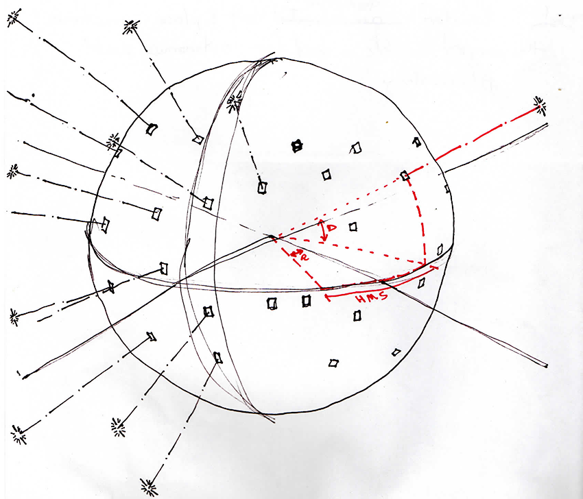
Mapping the World + Sky
Every Folly has coordinates that place it on a world map and in the stars.
This mapping system is part of the broader Follies framework, giving Autonomous Worlds a shared way to build environments, routes, constellations, and spatial meaning.
Coordinates let builders treat Follies as points of interest, constellations, or sources of power.
Right Ascension and Declination are the same coordinates astronomers use to map the night sky.
What You Can Do With Follies
Follies are building blocks for worlds.
- Build a game
- Create a story
- Generate a constellation
- Add lore
- Build an Autonomous World
- Extend the system
- Create new and unique visualizations
- Or build your own activation of the framework
The Four Pillars
The Follies Project stands on four conceptual Pillars.
- Existential Infrastructure
Small places that support transformation, story and character. - Composable Place Primitives
A flexible framework that any world can adopt, adapt or extend.
- Translational Data Structures
Simple numbers arranged to encode layered meaning. - Fiction + Lore * Technology
Story and code shaping each other - a world where narrative and architecture intertwine.
Next Steps
If you want to go deeper into the Follies Project, here's where to explore next:
- Read the Litepaper
A conceptual overview of the framework and how Follies work. - White Paper (Coming Soon)
A full technical breakdown of the system, including data structures, rendering logic, and how activations are built. - Loot Follies Mint (Coming Soon)
The first activation of the framework â€" a generative collection that demonstrates how Follies come to life onchain. - The Follies Archive (Coming Soon)
The lore, cultural history, and architectural lineage behind the structures, components, and meanings within the system. - Follow the Project
Updates and announcements are shared on X and in the Loot community.